1.Add “fence view” and “fence clear” in the map toolbar
Click “fence view” in the map toolbar to select the planned electronic fence and present it on the map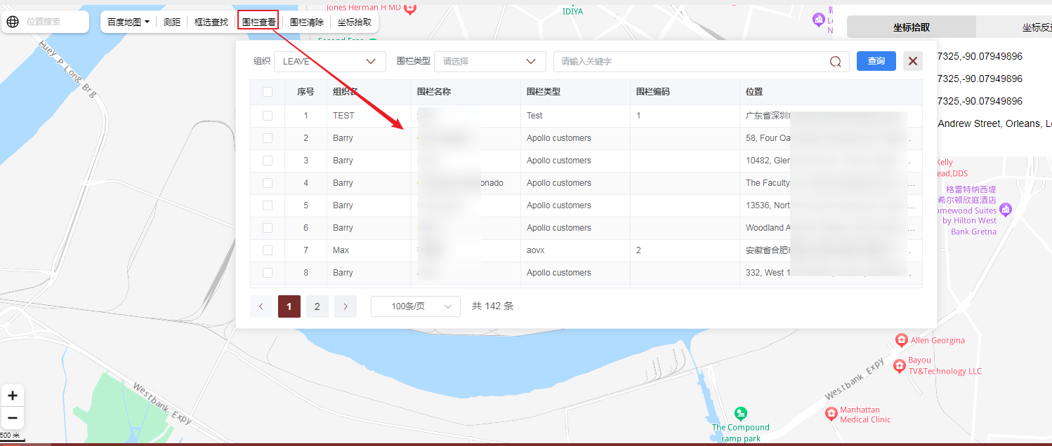
For example, if we select a fence, the information of the fence we just selected will be displayed on the map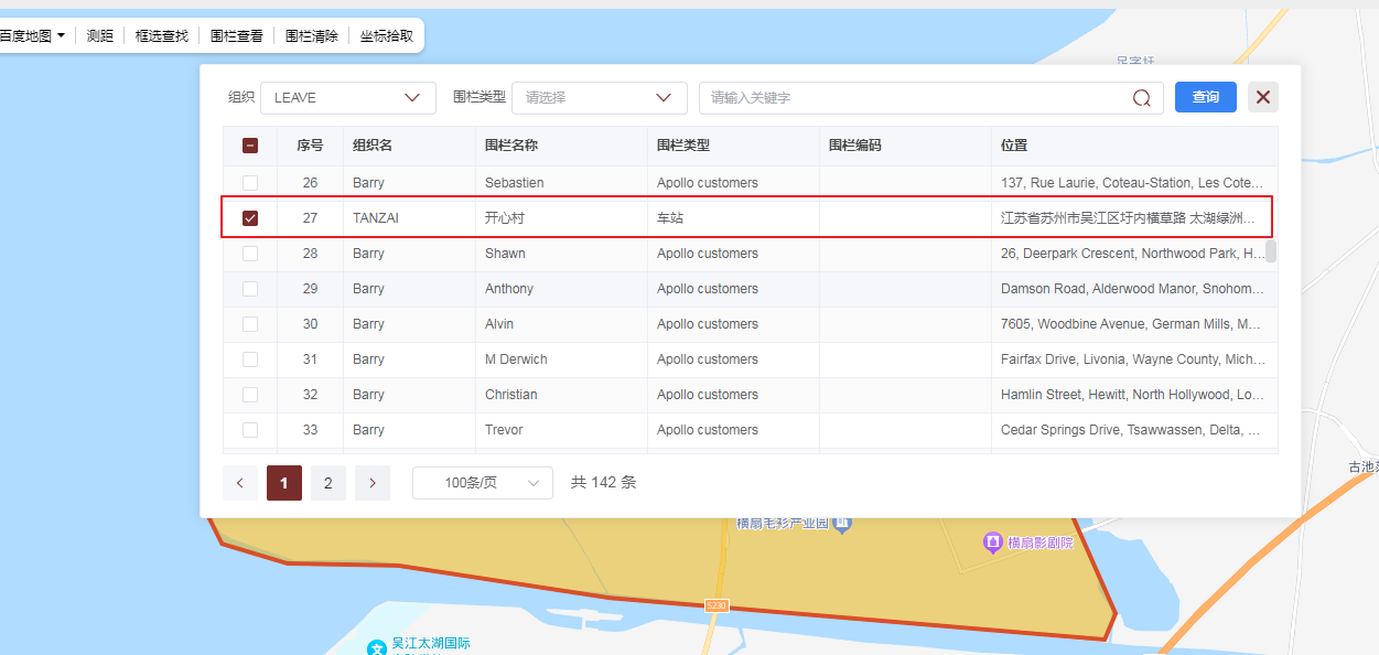
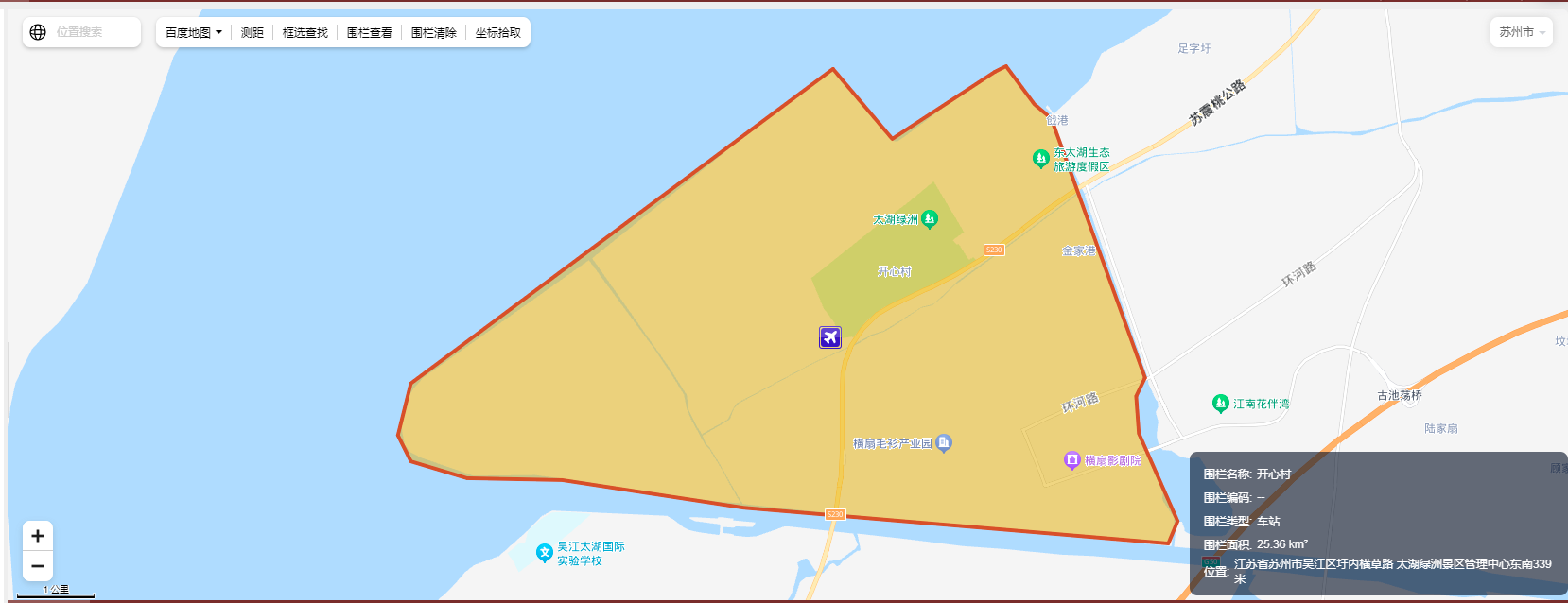
Click “fence removal” in the map toolbar to display the fence removal just presented on the map.
2.New tool “coordinate pick” added to the map toolbox
After clicking the “coordinate picking” tool, click the right mouse button on the map to finish picking the longitude and latitude coordinates of the points clicked on the current map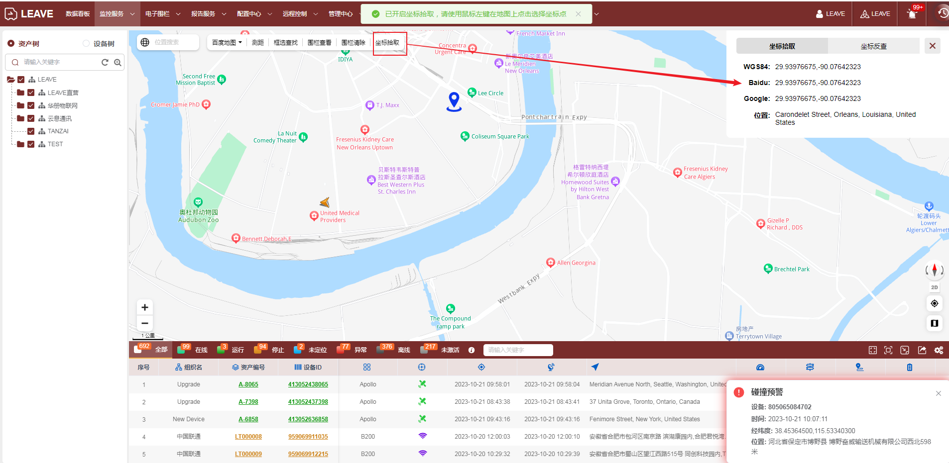
The format of coordinate picking is:lat,lon
The coordinate inverse query is through the longitude and latitude points, and then click the query button to display the location of the longitude and latitude in the map.
The input format of the input box is:lat,lon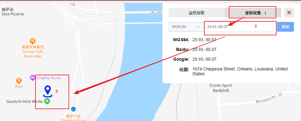
3.When querying the equipment track, the fence configured by the equipment will be displayed on the map by default
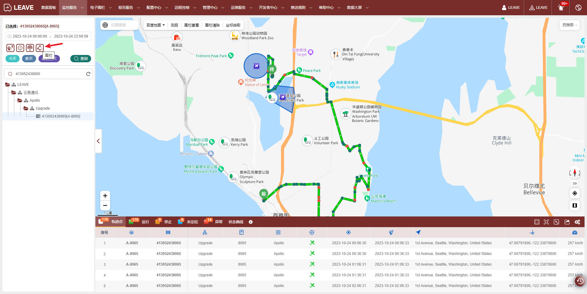
And whether the fence is displayed can be controlled according to the fence switch on the right.
最后编辑:admin 更新时间:2025-10-07 23:38
